![]() back to Stoke-on-Trent districts
back to Stoke-on-Trent districts
Districts
of the Stoke-on-Trent &
Newcastle-under-Lyme Conurbations
Northwood
![]()
![]()
![]()
next:
Trent Vale
previous:
Botteslow
Northwood
Northwood - A History of the County of Stafford Vol 8 |
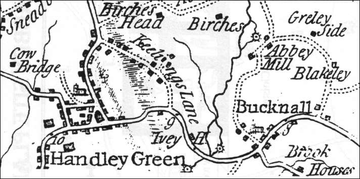
Keelings Lane shown on William Yates 1775 Map of Staffordshire
there
was housing on Keelings lane by 1775, however the road is shown as a
dotted line indicating that it was not a main road
Originally William Ridgeway's home - called Prospect House
Google Street View
| In 1829 William Ridgeway of Northwood attracted a new community to an area of land that reached from Town Road along Keelings Lane to the old Bucknall Road. A contemporary writer in praise of Ridgeway commented, "This is now a clean and desirable district that has seen good changes emerge from a rude demoralised part of Hanley into a beautifully well-organised hamlet." |
The Cat Inn - Keelings Road, Northwood
| The Cat Inn in Keelings Road is indeed an ancient inn. While the other 15 pubs in Northwood arrived as a result of beer-house legislation in 1830’s the Cat Inn has been there long before that. In fact it is well attested that men would turn out for a round of cock fighting from the end of the 18th century until well into Victorian times. |
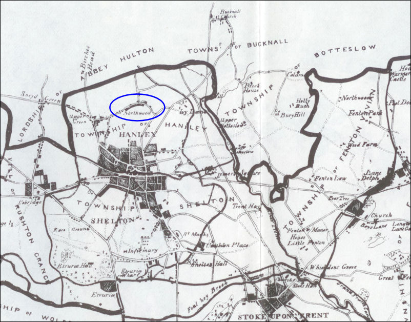
The location of Northwood - Ward's map of 1843
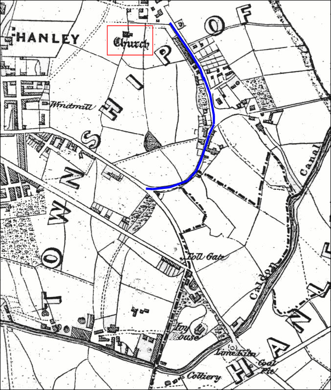
Extract from G. Lynam's 1848 map of the Parish of Stoke-on-Trent
Keelings
Lane is shown in blue
Holy Trinity Church is at the top of the map
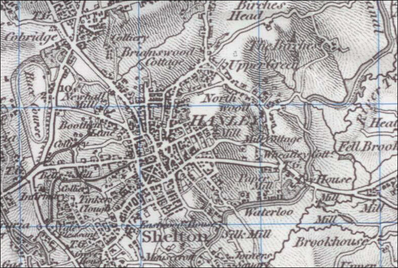
1833
Ordnance Survey map showing North Wood
all the houses are clustered around Keelings Lane
| By 1829 William Ridgway of Northwood House (earlier known as Prospect House) had changed the area 'from a rude and demoralized part of Hanley into a beautiful, cleanly, well-ordered hamlet' which was known as Northwood by 1832. |
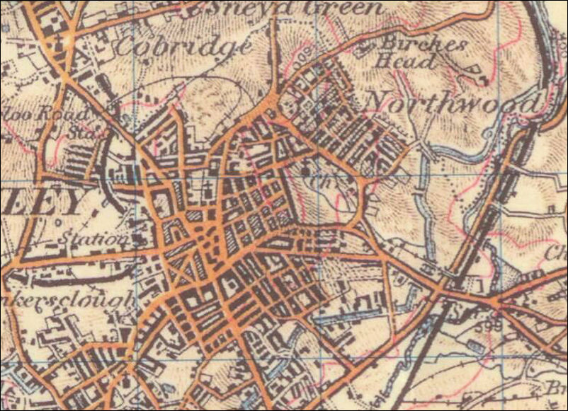
1902
Ordnance Survey map showing the growth of Northwood
Holy Trinity church can be seen - it was built in 1848
Northwood Park was not yet built.
| Several new streets were
built on the east side of Keelings Lane in the mid 1850's Others were
laid out on the south side of Providence Square, the former Upper Green.
A new terrace was built in Lower Mayer Street in 1870.
Northwood Park and the streets surrounding it are not yet laid out. |
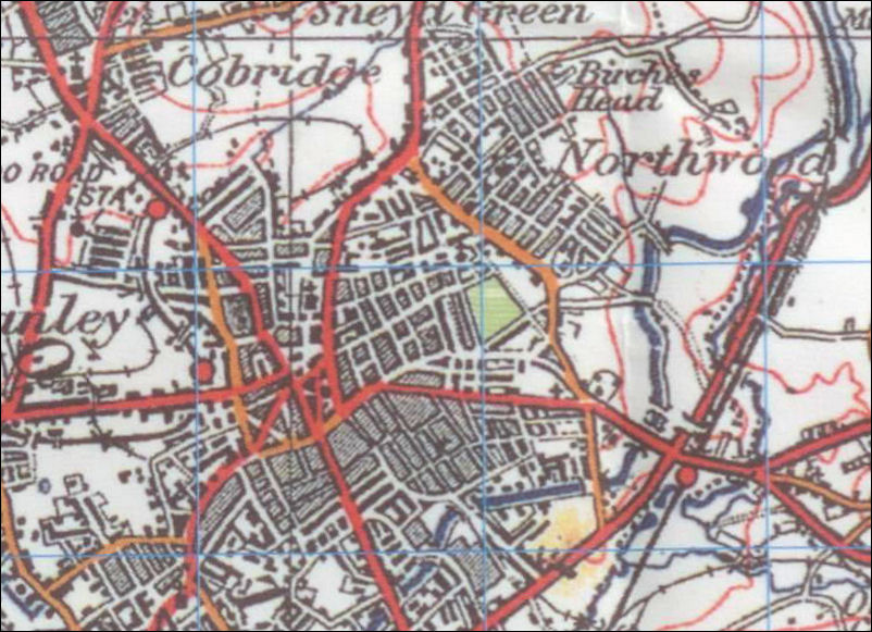
1922 Ordnance Survey map
| In the first decade of the 20th century the streets around Northwood Park were laid out; the park itself, some 11 acres in extent, was opened in 1907 as part of the jubilee celebrations of Hanley's incorporation. |
Holy Trinity Church of England, Northwood - Hanley
The
church of Holy Trinity in Lower Mayer Street was built in 1848–9,
and the population of the new parish was 3,300 in 1850
|
Church of England Parish A new parish covering the Northwood district was formed out of Stoke parish in 1845. The church of the Holy Trinity in Lower Mayer Street was built in 1848–9 on land given by Charles Smith of Elmhurst Hall near Lichfield. There was a Welsh curate attached to Holy Trinity, Northwood, by 1865 The living, at first a perpetual curacy and from 1868 a vicarage, has remained in the alternate gift of the Crown and the Bishop of Lichfield. The church, designed by J. Trubshaw, is built of stone in the Early English style and consists of an aisled nave, a chancel, and a north-west porch surmounted by a tower with a stone broach spire. It was seriously damaged by fire in February 1949, it was then restored and reopened in 1950. The vicarage, formerly at the west end of Cardwell Street, was in the early 1960's moved to Cromer Road; the old house became the Hollybush Inn. A History of the County of Stafford Vol 8 |
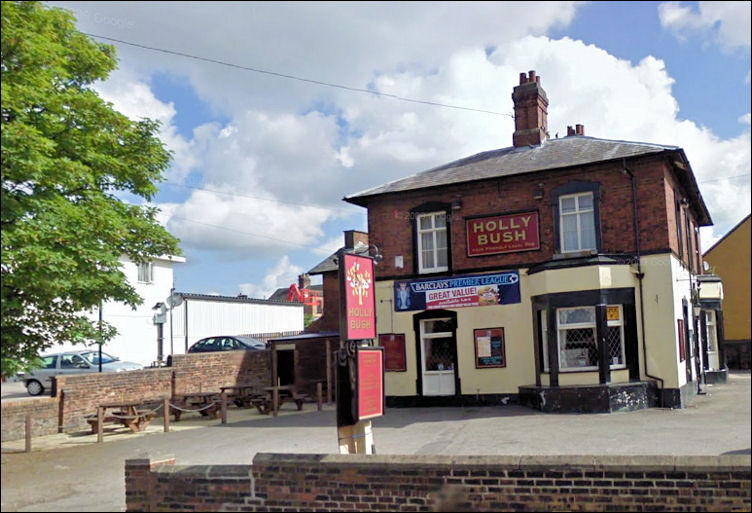
the Holy Bush public house on the corner of Cardwell Street and Keelings Road
originally the Vicarage to Holly Trinity
the statue of Temperantia returned to Northwood Park in 2007
Northwood Park opened in 1907, cost £9,500 and was built around an ancient fish pond
| "The opening of
Northwood Park by the Mayor of Hanley, Alderman T. Hampton, took place
on May 23rd, 1907, after a procession from Hanley Town Hall.
Although the park was then incomplete the opening was put forward to take place on the day celebrating the jubilee of the Incorporation of the Borough of Hanley. This park, which cost £9,500, is a delightfully " natural" park and contains a small lake— originally an ancient fish pool—after which Fishpool Walk was named (now Eastwood Road)." [note: became Fish Pond way and Eastbourne Road] a Sociological History of Stoke-on-Trent. Warrillow |
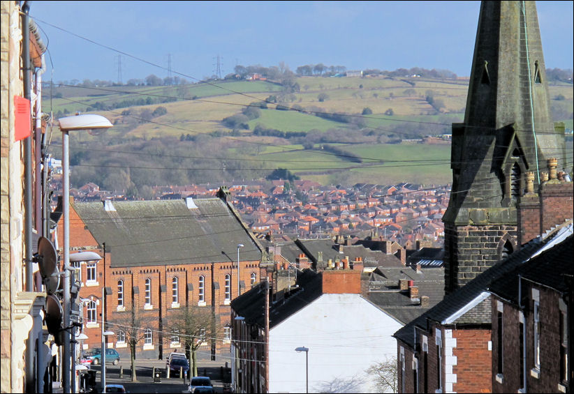
the
view down Lower Mayer Street from St. John Street, Northwood
at the bottom is Trinity Wesleyan Methodist Church,
on the right is the spire of Holy Trinity Anglican Church
Northwood C of E Junior School around 1957
|
The school was in effect built on a small island off Keelings Road with playgrounds on two sides. This photo was taken in the playground outside Mr Boggis’s classroom, Keelings Road can be seen behind and the junction with Cardwell Street is on the far right. The building on the far right was the vicarage to Holy Trinity Church - now this is the Holly Bush public house. |
![]()
![]()
![]()
next:
Trent Vale
previous:
Botteslow