![]()
|
|
|
|
|
Stoke-on-Trent - Potworks of the week |
Daisy Bank Marl
Hole, Longton
|
"Daisy Bank" Marl Hole and brick
and tile works, Longton. Showing the myrriad of potworks in the area.
Photographed by William Blake c.
1900-1940. |
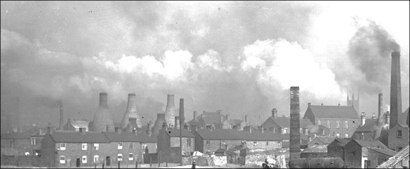
pottery works to the left of
St. James Church

Daisy Bank Brickworks -
Marl Hole, Longton
in the
rear, centre can be seen the tower of St. James Church which sits between
Uttoxeter Road and
Normacot Road - this helps to locate the view and the mirriad of pottery works
bottle ovens in the area
Clay is taken from the hole via the track, directly into the works,
the 'chard' or broken scrap ware can be seen on the left of the track, filling
the hole back up again.
The marl
pit was bordered by Spring Garden Road to the south and Edensor Road to the
west.
There were also the rather optimistically named Paradise and Orchard Streets
which are out of view on the left.
The terrace of houses in the top left of the image was known as Willow Row.
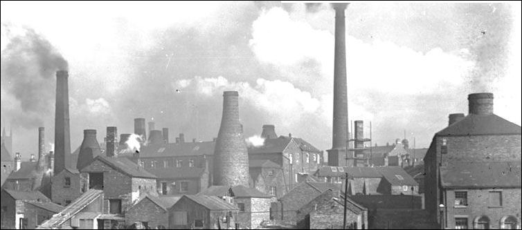
pottery works to the right
of St. James Church
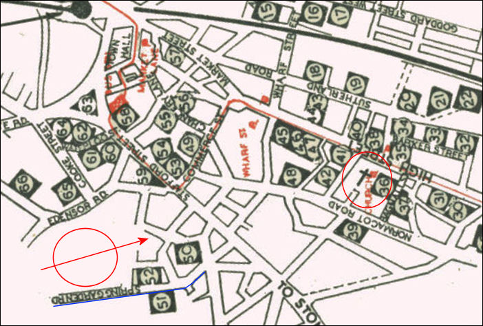
pottery works in Longton in
1947
the red circle is the location
of the Daisy Bank marl hole, alongside Spring Garden Road
the arrow shows the direction of the photograph towards St. James Church
the potworks in the area of the photograph were....
|
50 Cartwright & Edwards, Ltd. 51 Adderleys, Ltd. 52 Holdcrofts, Ltd. 30 Thos. Brian, Ltd. 31 Thomas Cone 32 Barker Bros., Ltd. 33 Sampson Smith, Ltd. 34 A. T. Finney, Blue Bell Pottery 35 Garfield Pottery, Ltd. 36 New Chelsea Porcelain Co., Ltd. 37 Hudson & Mlddleton, Ltd., Delphine Pottery 38 A. T. Finney, Duchess Pottery 39 Wm. Hudson 40 Chapmans, Longton, Ltd. 41 Winterton Pottery (Longton), Ltd. 42 Royal Albion China Co. 43 Hammersley & Co. (Longton), Ltd. 44 Doric China Co. 45 Gladstone China (Longton), Ltd. 46 Roslyn China 47 New Park Potteries, Ltd. 48 Shaw & Copestake, Ltd. |
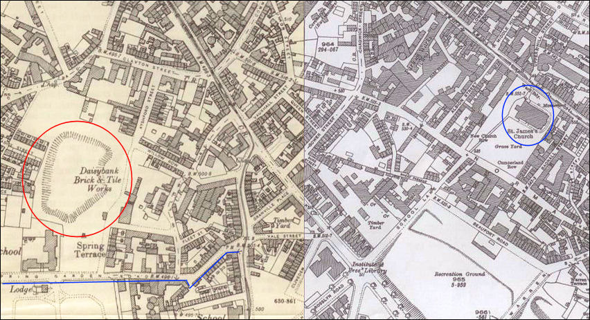
1898 map showing the location
of the Daisy Bank marl hole alongside Spring Garden Road
the bottle ovens are shown as small
circles
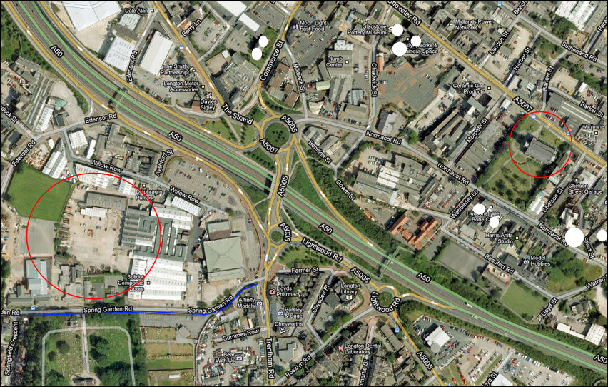
2009 Google map showing the
area of the marl hole alongside Spring Garden Road is now an industrial
estate
St. James Church is to the right of
the picture -
the white circles show the location of a few bottle ovens which are now
preserved as listed buildings
|
Related pages Brick Making - The location of brickyards has been dictated by the presence of clay beds, - derelict sites, represented by large holes were a prominent feature in the North Staffordshire brick making districts. Lane End was centred on the area around Market Street and the bottom part of Anchor Road and contained the Markets, Churches and main potworks. also see.. Advert
of the Week external sites... Staffordshire Past Track - Staffordshire Past Track has been developed with the aim of enhancing access to collections of material that represent the cultural identity and community history of Staffordshire. |